
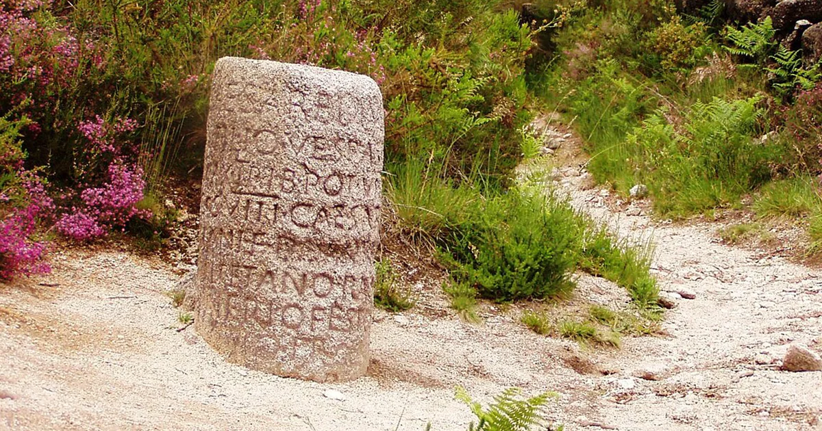
Walk along any major Roman road and you will find cylindrical stone columns standing at regular intervals, each bearing Latin inscriptions that tell you exactly where you are, how far you have traveled, and who built or repaired this stretch of highway. These monuments, called milliaria (singular: miliarium), transformed simple dirt tracks into a precisely measured imperial network that connected three continents. They were not decorative. They were functional tools of administration, maintenance, and movement that allowed Rome to govern an empire spanning 2.5 million square miles.
Understanding how these mile markers worked reveals how Rome managed distance, enforced accountability, funded infrastructure, and synchronized military and commercial movement across territories from Scotland to Syria. Every inscription followed a strict formula that any literate Roman could read instantly, creating a standardized information system that lasted over 400 years.
The Physical Structure and Legal Purpose of Roman Mile Markers
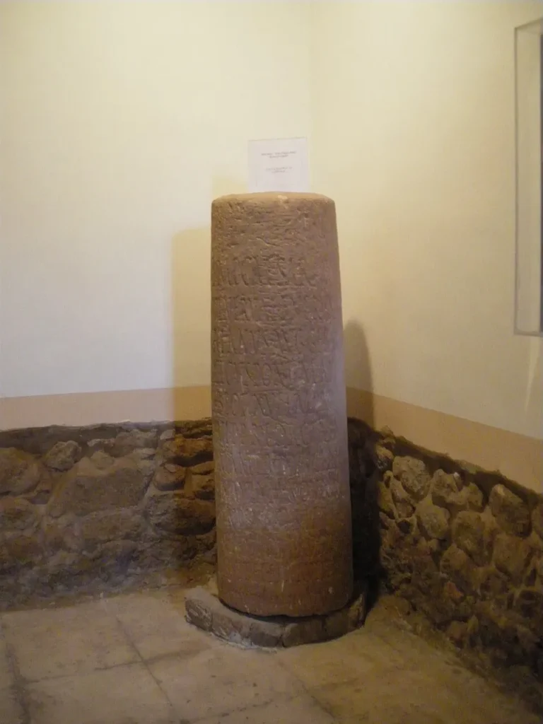
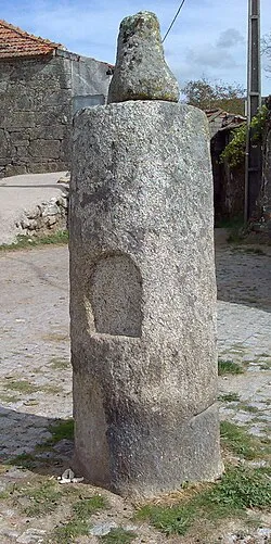
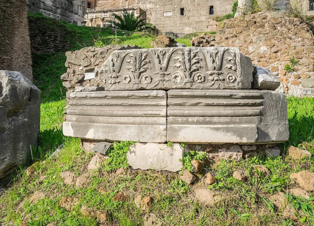
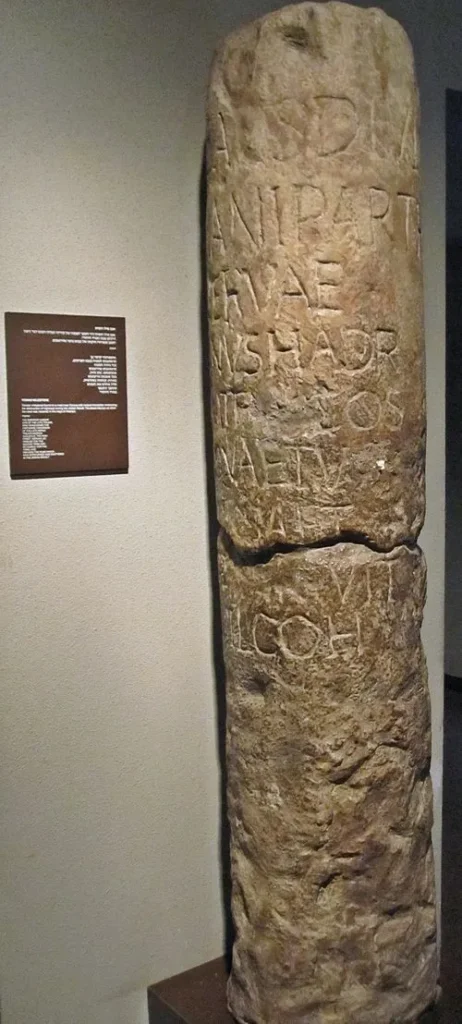
Roman mile markers were typically cylindrical stone columns carved from local materials, standing between 1.5 and 3 meters tall (roughly 5 to 10 feet). The columns rested on square or circular bases and featured inscriptions carved in capital letters on their visible faces. The size and material varied by region: Italian roads often used marble or travertine, while provincial roads employed whatever durable stone was locally available, including granite, limestone, or sandstone.
These markers served three essential functions. First, they measured distance using the Roman unit of milia passuum (thousands of paces), establishing precise location along each highway. Second, they identified the authority responsible for construction or maintenance, whether emperor, provincial governor, municipal council, or military commander. Third, they anchored roads within Rome’s legal framework by defining each highway’s classification and administrative responsibility.
A Roman mile measured exactly one thousand double steps (paces), where each pace counted the distance from heel strike to heel strike of the same foot. Since the Roman foot measured approximately 29.6 centimeters, a Roman mile equaled roughly 1,480 meters or 4,841 modern feet. This made the Roman mile about 92 percent the length of a statute mile (1,609 meters).
The legal classification embedded in each marker mattered significantly. A via publica was a major public highway under direct imperial or senatorial authority, funded from state resources. Viae militares served specifically military purposes and fell under legion or garrison supervision. Viae vicinales were local roads maintained by municipalities from their own budgets. The inscription’s language clarified which authority travelers could petition for repairs, where maintenance responsibility lay, and which officials could be held accountable if the road deteriorated.
How to Read a Roman Milestone Inscription
Roman mile marker inscriptions followed a standardized format that remained remarkably consistent across the empire’s vast geography and 400-year history. Modern epigraphers can date and interpret most milestones at a glance because the formula changed so little. Learning to read these inscriptions reveals not just distances but detailed administrative histories of road maintenance, imperial succession, and provincial governance.
The Authority Line: Names and Titles
Every milestone began by identifying who commissioned the work. Imperial milestones typically opened with IMP CAES (Imperator Caesar) followed by the emperor’s full name and accumulated titles. These titles were not mere honorifics but precise dating tools. The inscription listed tribunician power (tribunicia potestas, abbreviated TR P or TRIB POT) with a sequential number indicating how many years the emperor had held this power. Since tribunician years ran from specific dates, modern historians can often pinpoint construction to a single calendar year.
Similarly, consulship numbers (COS followed by a Roman numeral) provided dating precision. An inscription reading IMP CAES TRAIANVS AVG GERM DACICVS TR P XIII COS VI tells us Trajan was in his 13th year of tribunician power and his sixth consulship, allowing precise dating to 109-110 AD. Provincial governors or municipal officials who commissioned local roads included their titles: curator viarum (road superintendent), legatus Augusti pro praetore (imperial legate), or simply the local ordo (town council).
Republican-era stones predating the empire used different formulas, often naming the magistrate who supervised construction: consul, praetor, or censor, sometimes with tribal affiliations and family names. These earlier inscriptions were typically longer and more varied before Augustus standardized the system.
Road Identification and Distance Measurement
After the authority line came the road’s official designation. Major highways bore formal names: VIA APPIA, VIA FLAMINIA, VIA TRAIANA. These names honored their original builders (Appius Claudius Caecus for the Via Appia, Gaius Flaminius for the Via Flaminia) or the emperor who commissioned major reconstructions (Trajan for the Via Traiana). Some inscriptions simply noted the route’s termini rather than a formal name.
The mile number appeared in Roman numerals, either at the top, bottom, or middle of the inscription. For example, XIV indicated the fourteenth mile. This count always measured from the road’s caput viae, the official starting point, typically located at a city gate or major junction. On Italy’s trunk roads, the symbolic zero point was the Milliarium Aureum (Golden Milestone), a gilded bronze monument erected by Augustus around 20 BC in the Roman Forum, though actual measurements began at city gates rather than this symbolic marker.
Where two roads converged or a branch split off, inscriptions sometimes clarified which route the count followed. This prevented confusion at junctions where a traveler might encounter multiple milestone series. Some stones noted distances between major cities rather than just the mile count, particularly on long-distance trunk routes where travelers needed to know how far they had progressed toward their final destination.

Construction and Repair Language
The verbs carved into milestone inscriptions documented construction history with legal precision. FECIT meant “built” or “made,” indicating new construction. REFECIT or RESTITUIT meant “repaired” or “restored,” showing maintenance work on existing infrastructure. The phrase A SOLO (from the ground up) indicated complete reconstruction after catastrophic damage, distinguishing total rebuilds from routine resurfacing.
Some inscriptions included PER MILIA PASSUUM (through X miles) or PER M P abbreviated, specifying the length of road segment that had been built or repaired. This level of detail helped administrators track which sections needed attention and documented the scope of completed work. Occasionally, stones noted specific improvements: bridge reconstructions, widening projects, or rerouting after landslides or floods.
The verb choices created a maintenance record readable across generations. A traveler encountering a series of milestones could reconstruct repair history: an Augustan stone with FECIT showing original construction, a Claudian stone with RESTITUIT indicating repairs after 40 years of use, a Severan stone noting A SOLO rebuild after catastrophic flood damage. The stones functioned as a distributed archive of infrastructure maintenance.
Optional Details: Width, Supervision, and Dedications
While most milestones followed the core formula of authority, road name, and mile count, some included additional technical or administrative details. Width specifications appeared as P L (pedes lati, feet wide) followed by a number, documenting the road’s official width in Roman feet. This information mattered for commercial and military traffic, as it indicated whether the road could handle large wagons, artillery, or troop columns marching in formation.
Supervisory notes using CURANTE (under the care of) or CVRANTE followed by a personal name identified the official who directly oversaw construction. This created accountability: if workmanship proved substandard or if funds went missing, the named curator could be held responsible. In military zones, inscriptions sometimes named the legion or auxiliary unit that built the road: LEG III AVG (Third Augustan Legion) or similar designations.
Some stones included dedicatory language honoring the emperor’s family, victories, or virtues. These additions were more common in the eastern provinces, where Greek inscriptional traditions emphasized praise literature. Western milestones tended toward functional minimalism, though victory titles (GERMANICVS, DACICVS, PARTHICVS) appeared regularly after successful campaigns.
Who Built and Maintained Roman Roads
Roman road construction and maintenance involved a complex web of imperial, provincial, municipal, and military authorities. Understanding who paid for roads and who supervised their upkeep reveals how the empire balanced central control with local responsibility, and how infrastructure costs were distributed across government levels.
Imperial Administration and the Curatores Viarum
Augustus revolutionized road administration by creating the office of curator viarum around 20 BC. These appointed officials held responsibility for specific major highways, each curator overseeing one great road or a group of related routes. The curator viarum supervised repairs, contracted with mancipes (private contractors who bid for road construction projects), inspected work quality, and managed budgets allocated from the aerarium (state treasury) or from special imperial funds.
The position required significant technical knowledge, administrative skill, and financial acumen. Curatores viarum came from the senatorial or equestrian orders and often progressed to higher offices after proving their competence in road administration. Their work was highly visible: every milestone bearing an emperor’s name reflected the curator’s success or failure in maintaining that highway.
In the provinces, legati Augusti (imperial legates) or procuratores (financial administrators) supervised major road projects. These officials worked with military engineers, local contractors, and municipal authorities to plan routes, allocate resources, and inspect completed work. The milestone inscriptions naming these officials created a paper trail documenting who held responsibility at every level.
Municipal Responsibilities and Local Benefaction
Municipalities bore substantial road maintenance obligations. Town councils (ordines) were expected to maintain viae vicinales passing through their territories and sometimes stretches of major highways that crossed municipal boundaries. This burden fell particularly heavily on small towns along trunk routes, where imperial traffic damaged roads faster than local budgets could repair them.
In Italy and wealthy provinces, local elites often funded road construction or repairs as public benefactions. These acts of euergetism served multiple purposes: they genuinely improved infrastructure, they demonstrated loyalty to the emperor, and they enhanced the donor’s social prestige and political influence. The benefactor’s name appeared on milestone inscriptions alongside or instead of official titles, creating lasting public recognition of their generosity.
Examples abound of municipal officials using their own wealth to repair flood-damaged bridges, resurface worn sections, or build new routes connecting their towns to major highways. These acts were simultaneously practical (better roads meant more trade), political (benefactors could win elections or curry imperial favor), and social (public works displayed wealth and civic virtue).
Military Engineering and Campaign Roads
Roman legions were construction crews as much as fighting forces. Soldiers built roads during campaigns, creating supply lines and strategic corridors. When a campaign ended successfully and a conquered territory became a new province, these military roads often formed the foundation of the permanent highway network.
Military milestones naming specific legions (LEG II TRAIANA, LEG VII CLAUDIA) document which units built which roads. Legion commanders supervised construction, often using surveying skills and engineering knowledge gained through practical experience. Soldiers provided labor, while military budgets funded materials and skilled craftsmen.
Some campaign roads remained temporary, reverting to local tracks after armies moved on. Others, particularly those connecting strategic forts or following economically important routes, were upgraded to permanent highways. Later administrators sometimes replaced military milestones with imperial ones, standardizing the mile count and reassigning maintenance responsibility from legion to provincial government.
The Via Traiana in Italy and the Via Nova Traiana in Arabia exemplify this pattern: both were built under Trajan’s direct supervision, using military engineers and legion labor, then transferred to civilian administration once complete. The milestone inscriptions document this transition in their changing language and authority citations.
How Mile Markers Enabled Navigation and Travel Planning
Roman mile markers transformed abstract distance into practical travel information. For merchants calculating journey time, military officers planning troop movements, or imperial couriers maintaining delivery schedules, milestones provided the data needed to coordinate movement across the empire’s 250,000-mile road network.
Fixed Reference Points and Route Logic
Every major Roman road had an official zero point, the caput viae where mile counts began. For the Via Appia, counting started at Rome’s Porta Capena in the Servian Wall, then ran southeast through Capua toward Brundisium (modern Brindisi). The Via Flaminia began at the Porta Flaminia (later Porta del Popolo) and ran northeast across the Apennines to Ariminum (Rimini) on the Adriatic coast. The Via Traiana started at Beneventum (Benevento) and followed an interior route to Brundisium, providing a faster alternative to the coastal Via Appia.
When roads branched, each branch typically started its own mile count from the junction point. This meant a single road could have multiple counting systems: the Via Appia’s main line ran from Rome to Brundisium, but branches to Tarentum or other coastal cities counted separately. Travelers learned to ask locals or station staff which milestone series they were following and where the count originated.
The system’s logic was simple once understood: find the road name on the milestone, note the mile number, know the caput viae, and you could calculate your position and remaining distance to any major city along that route. This worked because roads were linear systems with known endpoints and because the milestones were maintained consistently enough that gaps or missing stones were unusual.
Speed, Staging, and the Cursus Publicus
The cursus publicus, Rome’s state postal and transport system established by Augustus, depended entirely on milestone-based distance calculation. This network of stations, couriers, and official transport served government communication and logistics, moving messages, documents, tax revenues, and officials across the empire at speeds that would not be matched again until the 19th century.
Mutationes (relay stations) were spaced approximately 8 to 12 Roman miles apart, providing fresh horses or mules for couriers and official travelers. These small facilities offered animal care, basic shelter, and nothing else. Mansiones (guest houses) appeared every 25 to 35 miles, offering overnight accommodation, meals, stabling, and sometimes baths. Both station types were located with reference to milestone counts, and administrators used the mile numbers when calculating staging efficiency and resource allocation.
Mounted couriers traveling on official business could cover extraordinary distances. Emergency dispatches might move 40 to 50 Roman miles daily in difficult terrain, 75 to 100 miles on good roads with efficient relay stations, and occasionally even more when conditions were ideal and the message was urgent. The milestone system made this possible: station masters knew exactly how far the next mutatio lay, couriers could calculate remaining distance to the next mansio, and provincial governors could estimate message transit times with reasonable accuracy.
For merchants and civilian travelers moving more slowly, milestones enabled equally important calculations. A merchant caravan with heavy wagons might cover only 15 to 20 miles daily. The mile markers let them plan rest stops, calculate when they would reach market cities, and estimate total journey time for perishable goods. Army units marching in column could maintain roughly 20 to 24 miles per day on good roads, with milestones helping officers coordinate the positions of vanguard, main body, and rear guard across extended columns.
Survey Precision and Terrain Adaptation
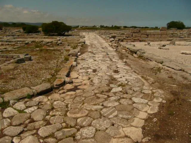
Roman road builders prioritized straight lines where topography allowed, but they were not rigid. When faced with mountains, rivers, marshes, or unstable slopes, engineers designed switchbacks, cuttings, embankments, and detours. Milestones followed the actual surveyed path, not theoretical straight-line distance, meaning the mile count reflected real travel distance including all curves and elevation changes.
This had practical implications. Two cities might be 50 Roman miles apart by straight-line measurement but 65 miles by road distance due to mountain passes or river crossings. The milestone count recorded the 65 miles because that was the distance a traveler actually covered. Modern archaeologists use surviving milestones to reconstruct lost road alignments, working backward from stone positions to map routes that are no longer visible on the ground.
When rivers changed course, landslides blocked passes, or bridges failed, roads were sometimes rerouted. New milestone counts were established for altered sections, and repair inscriptions occasionally noted these changes. The stones thus documented not just distance but also the roads’ evolving responses to natural disasters and landscape changes over decades or centuries.

Taxation, Tolls, and Administrative Control
Roman highways were generally toll-free within provinces, a policy that distinguished imperial infrastructure from the private toll roads common in medieval Europe. However, the empire did collect customs duties and regulated commercial traffic, and milestones played a role in defining where these administrative boundaries fell and how movement was monitored.
Portoria and Customs Boundaries
The Roman government levied portoria, customs duties on goods crossing provincial boundaries, certain river crossings, and harbor entrances. These were not tolls for road use but taxes on commerce itself. Rates typically ranged from 2 to 5 percent of cargo value, though they varied by province and commodity.
Milestones sometimes marked or stood near customs stations (stationes portorii) where officials inspected cargo and collected duties. While the stones themselves did not list tax rates or boundaries, their presence helped define the administrative geography where portoria applied. A milestone erected after a provincial boundary adjustment or following the suppression of a revolt might coincide with a reassertion of customs collection at that location.
In North Africa, for example, milestone inscriptions from the 2nd and 3rd centuries AD refer to road restorations after tribal uprisings. These repairs often accompanied the reestablishment of customs posts and military supervision of trade routes. The physical presence of imperial milestones signaled that Rome had restored control over both the road itself and the commercial traffic flowing along it.
Access to the Cursus Publicus
While the cursus publicus was a government service, private individuals could sometimes obtain permits (diplomata) allowing them to use postal horses, vehicles, and lodging. These permits were not free. Fees varied based on the level of service requested, and abuse of the system was common enough that emperors repeatedly issued edicts restricting access and punishing unauthorized use.
Milestones did not record these fees, but they marked the infrastructure where fees applied. A wealthy merchant with a diploma could calculate the cost of using government relay stations based on the distance indicated by milestones: X miles meant Y station changes, which meant Z cost in fees. This turned the milestone system into a pricing tool for those who could afford privileged access to government transport.
The system was controversial. Provincial populations complained that officials and their wealthy friends exploited postal privileges, commandeering animals and supplies beyond what regulations allowed. Emperors attempted reforms, but enforcement proved difficult across such vast distances. The milestone network that made the cursus publicus efficient also made its abuses more visible and calculable.
Jurisdiction, Maintenance Disputes, and Legal Authority
Milestone inscriptions served as legal evidence in disputes over road maintenance responsibility, boundary definitions, and right-of-way conflicts. When a municipality claimed a stretch of road fell outside its maintenance zone, the milestone inscription documenting which authority built or last repaired that section could settle the argument. Similarly, if private landowners encroached on public road easements, the stones helped define where the via publica legally ran.
The formula of naming the responsible official (emperor, governor, curator, or town council) meant travelers or municipalities knew exactly whom to petition when bridges collapsed, surfaces deteriorated, or bandits made roads unsafe. This accountability mechanism worked imperfectly, as any bureaucracy does, but the principle was clear: the stone named who owed the duty of repair, making negligence identifiable and, theoretically, punishable.
In frontier provinces, milestones also marked jurisdiction in a more military sense. A stone bearing a legion’s name indicated that military law applied in that zone, that military patrols supervised the road, and that disputes might be adjudicated by military rather than civilian courts. This added layer of meaning made milestones part of the empire’s territorial control mechanisms, not just its transportation network.
Built out of a love for history, kept free from distractions.
Spoken Past is an independent project shaped by curiosity, care, and long hours of research. Reader support helps keep it maintained, carefully researched, and open to everyone.
Maintenance Records in Stone
The repair verbs carved into milestone inscriptions created a distributed maintenance archive that tracked how roads were kept functional across centuries. Reading these verbs with care reveals patterns in infrastructure investment, responses to natural disasters, and the administrative continuity that kept the road network operational through dynastic changes and political upheavals.
Understanding Construction and Repair Terminology
FECIT (made, built) indicated original construction. When you see this verb on a milestone, you are looking at a stone that commemorates the road’s initial creation. These inscriptions typically appear on roads built under single, coordinated campaigns: Trajan’s Via Traiana, Domitian’s roads in Germania, or Augustus’s strategic highways in Gaul.
REFECIT (remade, repaired) or RESTITUIT (restored) marked maintenance work on existing roads. This was the most common verb on later imperial milestones because most roads had been built during the Republic or early Empire, and subsequent generations focused on preservation rather than new construction. These repair stones often appeared in clusters: one stone from Claudius with RESTITUIT, another from Trajan, another from Septimius Severus, each recording successive repair campaigns along the same stretch.
A SOLO (from the ground, from scratch) signaled complete reconstruction, usually after catastrophic damage from floods, earthquakes, landslides, or warfare. This phrase indicated that engineers had rebuilt the road’s entire structure: removing old paving, re-excavating the foundation trench, replacing drainage systems, and laying new stone courses from statumen (foundation) through rudus (middle layer) to summum dorsum (wearing surface). Such work was expensive and time-consuming, so A SOLO inscriptions mark significant events in a road’s history.
When inscriptions added PER MILIA PASSUUM (through X miles), they specified the exact length of road segment repaired. A stone reading VIAM A BENEVENTO BRUNDISIVM REFECIT PER M P XX meant the official had repaired 20 miles of the Via Traiana. This precision helped administrators track which sections had received attention and plan future maintenance cycles.
Clustering and Sequential Repairs
Archaeological surveys often find multiple milestones at single locations, each commemorating different repair campaigns. Rather than demolishing old stones and reusing the material, later administrators typically erected new markers beside earlier ones. This created chronological sequences visible on the ground: three or four stones standing near each other, each from a different emperor, together documenting 150 or 200 years of continuous maintenance.
These clusters are invaluable for historians. They reveal repair frequencies: were roads maintained every generation, or did they deteriorate for decades before major restorations? They show which emperors invested in infrastructure and which neglected it. They sometimes document responses to specific crises: multiple repair stones from the mid-3rd century AD often relate to damage from civil wars or barbarian invasions during the imperial crisis.
The clusters also reveal maintenance philosophy. Roman engineers understood that preventive maintenance was more efficient than deferred repairs. Roads receiving regular attention every 20 to 30 years could often be resurfaced without rebuilding foundations. Roads neglected for 50 or 60 years typically required A SOLO reconstruction because subsurface drainage had failed and the entire roadbed had deteriorated.
Engineering Details in Repair Inscriptions
Some milestone inscriptions provided technical details beyond simple repair verbs. Bridges received special mention because they were expensive, complex structures vulnerable to flood damage. A stone might note PONTEM RESTITUIT (bridge restored) or name a specific river crossing rebuilt during road repairs.
Width specifications occasionally appeared when roads were widened to accommodate heavier traffic. An inscription noting VIAM LATAVIT (widened the road) followed by a measurement in Roman feet documented significant engineering work: excavating more land, building wider retaining walls, and paving a broader surface. Such widening typically responded to increased commercial traffic or new military logistics requirements.
Culverts and drainage systems rarely received explicit mention in milestone texts, but the engineering literature and archaeological evidence show that these subsurface features required constant maintenance. When roads failed, it was usually because water infiltration had compromised foundations. The repair verbs REFECIT and A SOLO implicitly included drainage restoration, though the stones did not spell this out. Engineers and administrators understood that “repairing the road” meant repairing the complete system: surface, foundation, drainage, and any associated structures.
Regional Variations Within Imperial Standardization
While the milestone inscription formula remained remarkably consistent across the empire, regional variations in materials, stonecutting styles, and even some terminological choices reflect local practices and the realities of governing diverse territories separated by thousands of miles.
Italy and the Classic Form
Italian milestones, particularly those along the great trunk roads radiating from Rome (Via Appia, Via Flaminia, Via Aemilia, Via Aurelia, Via Latina), represent the classic form that became the empire-wide standard. These stones typically used white marble or travertine, stood on carefully finished bases, and featured deeply cut letters with serifs and careful spacing. The inscriptions strictly followed the formula: imperial name and titles, road designation, mile number, and any relevant repair verbs.
The Milliarium Aureum in Rome, though now reduced to a fragmentary core of brick and concrete, originally served as the symbolic zero point for these roads. Erected by Augustus around 20 BC, it was gilded bronze bearing inscriptions listing distances to major cities throughout the empire. Its placement in the Forum Romanum next to the Temple of Saturn made it both a practical reference point and a monument to imperial unification through infrastructure.
Italian stones often show superior craftsmanship because workshops near Rome had access to skilled stonecutters trained in monumental epigraphy. The letters are evenly spaced, properly aligned, and cut to consistent depths. Provincial stones, while following the same formula, sometimes show rougher execution, uneven letter sizes, or abbreviated terms reflecting less experienced carvers or tighter budgets.
Provincial Adaptations: Materials and Language
Provincial milestones adapted to available resources while maintaining the informational structure. In Gaul and Germania, local limestone or sandstone replaced marble. In Britain, hard volcanic stones and granites were common. In North Africa, engineers used whatever sedimentary stone was quarried nearby, often softer materials that weathered more quickly but were easier to transport and carve.
The eastern provinces introduced language complexity. Greek had been the administrative language of the Hellenistic kingdoms Rome conquered, and it remained dominant in daily life. Eastern milestones sometimes carried bilingual inscriptions (Latin and Greek in parallel texts) or purely Greek inscriptions following the same formula as Latin ones. The mile count converted to stadia (the Greek distance unit, roughly 185 meters) in some regions, though most administrators standardized on Roman miles for consistency.
Egypt presented unique challenges. The province had its own measurement system (schoinoi) used for centuries along Nile routes. Roman administrators gradually introduced milestones with standard Roman miles, but the transition was incomplete. Archaeological evidence shows mixed systems: some stones using Roman miles, others using traditional Egyptian distances, and some attempting bilingual distance notations that must have confused travelers unfamiliar with both systems.
Military Frontiers and Strategic Roads
Frontier provinces along the Rhine, Danube, and eastern borders developed distinctive milestone characteristics reflecting military priorities. Stones in these regions more frequently named specific legions or auxiliary units, emphasized fortification connections, and sometimes included security-related language absent from civilian trunk roads.
British milestones from Hadrian’s Wall and the road networks of northern Britain often included dedications that doubled as loyalty statements. After the suppression of rebellions or usurpations, new governors erected milestones proclaiming allegiance to the legitimate emperor. These served both practical navigation purposes and political messaging: the stones announced that Roman authority had been restored and that the road network was again secure for imperial traffic.
The Via Nova Traiana connecting Bostra (in Syria) to Aila (modern Aqaba) on the Red Sea exemplifies strategic military roads in the East. Completed around 111-114 AD, this highway secured Rome’s Arabian frontier and facilitated trade with India via Red Sea ports. The milestones, many now in museums in Jordan and Israel, show the standard imperial formula but in a landscape where military and commercial functions were inseparable. The road served legion movements, caravan trade, and administrative travel simultaneously.
Reading Milestones in the Field: A Practical Guide
For modern visitors encountering Roman milestones in archaeological sites, museums, or still standing along ancient roads, knowing how to read the inscriptions transforms stone cylinders into detailed historical documents. Here is a systematic approach to extracting maximum information from these monuments.
The Top-to-Bottom Reading Method
Begin at the inscription’s top line, where the emperor’s name and primary titles appear. Look for standard abbreviations: IMP (Imperator), CAES (Caesar), AVG (Augustus), GERM (Germanicus), DAC (Dacicus), PARTH (Parthicus). These victory titles help narrow the dating range: an emperor called GERMANICVS won victories in Germania, one called DACICVS conquered Dacia.
Next, locate the tribunician power notation: TR P, TR POT, or TRIB POT followed by a Roman numeral. This number is the emperor’s regnal year, counting from when he assumed tribunician power (typically at accession). Cross-reference this with historical records to determine the exact year. For example, Marcus Aurelius held tribunician power for 19 years (161-180 AD), so TR P X dates a stone to 170 AD.
Find the consulship indicator: COS followed by a numeral. Most emperors held multiple consulships, often ceremonially, but the number helps confirm dating when combined with tribunician years. PP means pater patriae (father of the fatherland), an honorific title granted by the Senate.
Move down to the road identification line. Look for VIA APPIA, VIA TRAIANA, or similar designations. If the road name is absent, check whether termini are listed: A ROMA CAPVAM (from Rome to Capua) or similar phrasing.
Locate the mile number, typically in large Roman numerals: I through XX for miles 1 through 20, XXX for 30, XL for 40, L for 50, C for 100, and so on. The number may appear at the inscription’s top, middle, or bottom depending on the stonecutter’s design.
Check for repair verbs: FECIT, REFECIT, RESTITUIT, A SOLO. These small words reveal whether this stone marks original construction or later maintenance. If you find PER M P followed by a number, that tells you how many miles of road were built or repaired in that campaign.
Decoding Abbreviations and Damaged Inscriptions
Roman stonecutters abbreviated extensively to fit text onto limited surface area. Common abbreviations include: IMP (Imperator), CAES (Caesar), AVG (Augustus), P M (Pontifex Maximus), P P (Pater Patriae), COS (Consul), TR P (Tribunicia Potestas), LEG (Legio), CUR VIAR (Curator Viarum), PROC (Procurator), REFEC (Refecit), REST (Restituit), M P (Milia Passuum).
When inscriptions are damaged or weathered, context helps reconstruction. If you can read “IMP CAES M AVR [ ]” followed by “TR P [ ] COS III,” you know this is Marcus Aurelius (M AVR[ELIVS]) or possibly Marcus Aurelius Antoninus (Caracalla). The COS III (third consulship) helps distinguish between emperors with similar names.
Letter shapes and carving styles also provide dating clues independent of text content. Classical Roman capitals from the 1st and 2nd centuries AD show precise proportions, even spacing, and confident execution. Later 3rd and 4th century inscriptions often display more variable letter forms, shallower cutting, and less precise alignment, reflecting declining stonecutting standards and tighter budgets.
Connecting Stones to Landscape Context
A milestone’s location relative to other archaeological features reveals additional information. If you spot river crossings nearby, check the inscription for bridge construction or repair language. The stone may commemorate not just road resurfacing but also bridge rebuilding after flood damage.
Look for remains of posting stations (mutationes and mansiones) within sight of milestones. These facilities were spaced according to mile counts, so finding station ruins at 8-mile or 12-mile intervals confirms that the milestone system functioned as designed. In frontier zones, check for fort remains or watch towers visible from the road: military installations positioned at specific mile intervals show how defense infrastructure integrated with the highway network.
Multiple milestones clustered at one spot indicate repeated repairs over time. Read them chronologically (using dating evidence from imperial names and titles) to reconstruct a maintenance timeline. A sequence of stones from Augustus, Claudius, Trajan, and Septimius Severus documents 200 years of continuous attention to that road segment.
If the stone stands along a modern road that roughly follows the ancient alignment, compare the mile intervals marked by surviving stones. Where gaps appear, the Roman road may have deviated from the modern route, or stones may have been removed, reused in medieval construction, or remain undiscovered buried alongside the roadway.
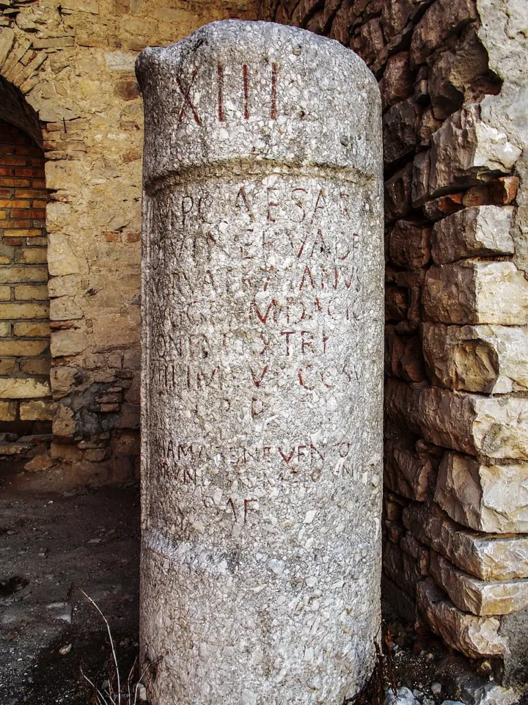
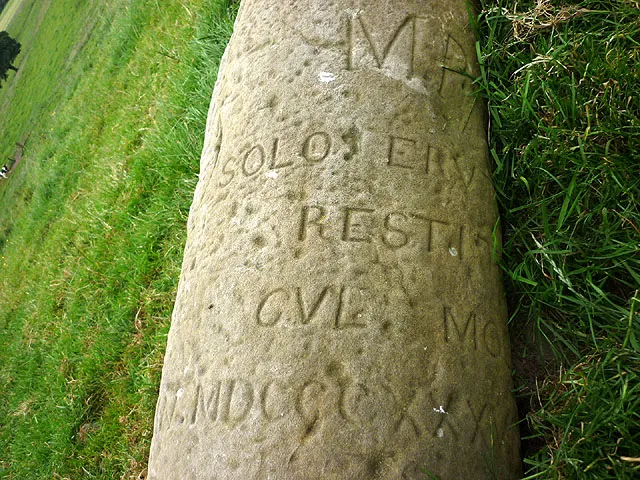
Case Study: Trajan’s Via Traiana Mile XIV
A milestone discovered near Buonalbergo in southern Italy exemplifies how a single stone encapsulates imperial policy, engineering achievement, and practical navigation. This cylinder of white marble, now roughly 2 meters tall (possibly originally taller), marks the fourteenth mile of the Via Traiana, the highway Trajan built to provide a faster route from Beneventum to Brundisium, shortening the journey compared to the coastal Via Appia.
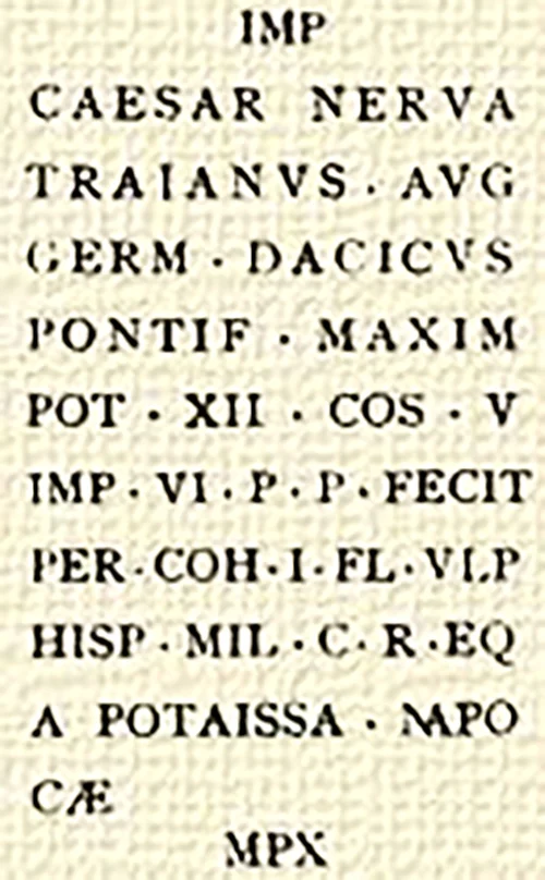
The inscription begins: IMP CAESAR DIVI NERVAE F NERVA TRAIANVS AVG GERM DACICVS. This translates as “Emperor Caesar Nerva Trajan Augustus Germanicus Dacicus, son of the deified Nerva.” The victory titles Germanicus and Dacicus indicate the stone was carved after Trajan’s Dacian Wars (101-102 and 105-106 AD), which ended with Dacia becoming a Roman province in 106 AD.
The next line continues: PONTIF MAXIM TRIB POTEST [number unclear] IMP VI COS V. Pontifex Maximus was the chief religious office, held by all emperors after Augustus. The IMP VI indicates Trajan’s sixth acclamation as Imperator (a military honor voted after victories), while COS V marks his fifth consulship. Cross-referencing these with historical records dates the stone to around 109-111 AD.
Below this appears: VIAM A BENEVENTO BRUNDISIVM PECVNIA SVA FECIT. This translates: “He built the road from Beneventum to Brundisium with his own money.” The phrase pecunia sua (with his own money) is significant. Technically, all imperial funds were “the emperor’s money” drawn from revenues, but this phrasing emphasizes that Trajan personally funded the project rather than drawing from the regular senatorial treasury (aerarium). This was propaganda: Trajan presenting himself as a benefactor who improved infrastructure at personal expense.
At the bottom: XIV (fourteen). This locates the stone precisely: 14 Roman miles from Beneventum along the Via Traiana heading toward Brundisium. For a traveler in 110 AD reading this stone, the information was comprehensive: you are on Trajan’s new road, 14 miles from Beneventum, approximately 100 miles still to go to reach Brundisium, and this highway was built by the emperor who conquered Dacia and is now enriching Italy with that conquest’s spoils.
If you could walk the Via Traiana today and find stones XIII, XIV, and XV still in position, you would see the one-mile rhythm Roman surveyors maintained. The actual distances between these stones, measured over modern terrain, would reveal how closely Roman milestones matched theoretical mile intervals: surveyors were remarkably accurate, typically within 50 meters or less over one-mile segments, despite working without modern instruments.
This single stone documents: imperial identity and legitimacy (through titles and genealogy), military victories (Germanicus, Dacicus), religious authority (Pontifex Maximus), administrative tenure (tribunician years, consulships, imperator acclamations), infrastructure investment (road construction), financing mechanisms (pecunia sua), and precise navigation (mile XIV from Beneventum). It is a comprehensive government document carved in stone and planted where thousands of travelers would read it daily.
What Milestones Reveal About Roman Administration
Beyond their practical navigation function, mile markers illuminate how the Roman Empire managed vast territories, maintained accountability across administrative hierarchies, and created continuity despite frequent changes in leadership. These stones were not merely distance markers but components of a sophisticated governance system.
Standardization Without Uniformity
The Roman Empire never mandated a single milestone design. Stone shapes varied: some cylinders were tall and narrow, others short and squat; some stood on elaborate bases, others on simple plinths. Materials differed by region: marble in Italy, granite in Egypt, limestone in Gaul, sandstone in Britain. Yet the information structure remained constant. From Hadrian’s Wall to the Euphrates River, anyone trained to read Latin could parse a milestone’s essential data within seconds.
This combination of flexible form and rigid content structure exemplifies Roman administrative philosophy: centralized control over information systems and legal frameworks, decentralized implementation adapted to local conditions. The empire did not try to impose Italian marble on British roads where no marble existed, but it did insist that British milestones follow the same informational formula as Italian ones.
The standardization created a shared language of infrastructure that survived political fragmentation. When civil wars periodically split the empire into competing regimes, rival emperors still erected milestones following the traditional formula. When dynasties changed, new rulers replaced old milestones with new stones using the same format. The information system outlasted individual administrators because it was institutionalized in stone and practice.
Carved Accountability
Every milestone functioned as a signature on a contract. By carving his name onto a stone marking road construction or repair, an emperor, governor, or municipal official publicly claimed credit and accepted responsibility. If the road subsequently failed due to poor workmanship or inadequate maintenance, the stone stood as evidence of who had last claimed to have fixed it.
This accountability mechanism worked imperfectly, as all bureaucratic systems do. Corrupt officials could claim repairs they never performed, or perform them shoddily while pocketing funds. Distance from Rome made oversight difficult in remote provinces. Yet the system established the principle that infrastructure investment should be documented, attributed, and subject to verification. Modern highway departments posting construction signs that name contractors and completion dates follow a Roman precedent 2,000 years old.
The stones also created continuity across administrations. When a new emperor succeeded, he inherited not just legions and tax revenues but also thousands of stone monuments documenting his predecessor’s infrastructure investments. If he wanted to claim equal competence, he needed to add his own stones. If he wanted to surpass his predecessor, he needed to build new roads or repair more miles than previous emperors. The milestone network turned infrastructure maintenance into a competitive arena where emperors demonstrated their effectiveness.
Integrating Space and Time
Mile markers transformed abstract geographical space into measured, legible, administratively useful territory. Before milestones, travelers knew distances imprecisely: “three days’ journey” or “past the second river crossing.” Milestones provided exact measurements that enabled precise calculation of travel time, resource needs, and logistics planning.
This precision mattered enormously for military operations. An army commander planning a campaign could calculate exactly how many days march separated his garrison from a threatened frontier, how many supply depots he needed at what intervals, and when reinforcements from distant provinces would arrive. The cursus publicus could schedule message transit with enough accuracy that emperors in Rome could coordinate policies with governors 1,000 or 2,000 miles away, knowing approximately when their dispatches would arrive and when responses could be expected.
Tax collection also depended on measured distances. Provincial officials calculated transport costs for grain, precious metals, and other tax revenues based on milestone counts. Merchants bidding for transport contracts used mile numbers to estimate expenses. The stone cylinders standing beside roads served as reference points for an entire economic system built on predictable transportation costs.
The integration of space and time through milestone measurement helped create what historians call the “Roman Peace” (Pax Romana). When movement became predictable, trade flourished. When military response times could be calculated, frontier defense became more efficient. When tax transport costs were known, revenue collection improved. The humble mile markers, viewed collectively, were infrastructure that made the empire legible and therefore governable across unprecedented distances.
Frequently Asked Questions About Roman Mile Markers
How long was a Roman mile compared to a modern mile?
A Roman mile measured approximately 1,480 meters or 4,841 modern feet, making it roughly 92 percent the length of a statute mile (1,609 meters or 5,280 feet). Romans calculated their mile as one thousand paces (milia passuum), where each pace was a double step measuring both feet returning to the same position. Since a Roman foot was approximately 29.6 centimeters (11.65 inches), this produced the slightly shorter Roman mile compared to the modern standard adopted in English-speaking countries.
Where did Roman roads start counting miles?
Each major Roman road had an official starting point called the caput viae (head of the road), typically located at a city gate or major junction. For example, the Via Appia’s mile count started at the Porta Capena in Rome’s Servian Wall, while the Via Flaminia began at the Porta Flaminia (later Porta del Popolo). In Italy, the Milliarium Aureum (Golden Milestone) erected by Augustus in the Roman Forum around 20 BC served as a symbolic zero point for all roads, though actual measurements still began at individual city gates. Provincial roads counted from their own designated starting points, often the capital city of a province or a major military fortress.
Did milestones show directions or just distances?
Most milestones showed only the mile count from the road’s starting point, not directional information, because the linear nature of Roman roads made direction implicit. If you were on the Via Appia and saw mile marker XV, you knew you were 15 miles from Rome and could calculate your distance to Capua based on your knowledge of the road’s total length. At road junctions where multiple routes converged, some milestones clarified which branch the count followed, but explicit directional guidance was uncommon. Travelers relied on asking locals or consulting itineraries (written road guides) for directional information.
What do the Latin repair verbs on milestones mean?
FECIT means “made” or “built,” indicating original road construction. REFECIT means “remade” or “repaired,” marking routine maintenance on an existing road. RESTITUIT means “restored,” typically after more serious deterioration. A SOLO means “from the ground up,” signaling complete reconstruction of the road’s foundation and surface after catastrophic damage from floods, landslides, or warfare. When followed by PER MILIA PASSUUM and a number, these verbs specified the exact length of road segment that was built or repaired, providing precise documentation of infrastructure investment.
Who actually paid for Roman road construction and repairs?
Road funding came from multiple sources depending on the road’s classification and location. Major imperial highways (viae publicae) were funded from the state treasury (aerarium) or from special imperial allocations, with work supervised by curatores viarum appointed by the emperor or Senate. Provincial roads received funding from provincial budgets managed by governors or procurators. Municipal roads (viae vicinales) were maintained by local town councils from municipal taxes. Military roads were built and maintained by legions from military budgets. Wealthy individuals sometimes funded road construction as public benefactions, gaining social prestige and political influence in return. The milestone inscription identified who paid, creating public documentation of infrastructure investment.
Were there tolls on Roman roads?
Regular tolls for road use were generally not charged on Roman public highways within provinces, distinguishing imperial infrastructure from medieval European toll roads. However, the empire did levy portoria (customs duties) on goods crossing provincial boundaries, certain river crossings, and harbor entrances. These were taxes on commerce itself, typically 2 to 5 percent of cargo value, not fees for road access. Milestones sometimes stood near customs stations where portoria were collected, but the stones themselves did not list tax rates. The cursus publicus (state postal system) charged fees to private individuals who obtained permits to use government transport, but these were system access fees rather than road tolls.
How often were milestones placed along Roman roads?
Major Roman highways had milestones at every Roman mile (approximately 1,480 meters or 4,841 feet). Surveyors were remarkably accurate, typically placing stones within 50 meters of theoretical one-mile intervals despite working without modern measuring instruments. Gaps in milestone sequences today usually indicate missing stones that have been removed, buried, or reused in later construction rather than original spacing irregularities. Secondary roads and military tracks sometimes had less regular milestone placement, particularly in difficult terrain where exact measurement was challenging.
How did the cursus publicus postal system use milestones?
The cursus publicus, Rome’s state postal and transport system established by Augustus, depended entirely on milestone-based distance calculation for scheduling and logistics. Mutationes (relay stations for fresh horses) were placed approximately every 8 to 12 Roman miles based on milestone counts. Mansiones (overnight stations) appeared every 25 to 35 miles. Postal couriers calculated journey times and planned relay stages using milestones: a courier might know he could reach the next mutatio in one hour at full gallop, plan to change horses there, and estimate total journey time to a destination 100 miles away. Station masters used milestone data to stock adequate supplies and animals for expected traffic volumes.
Why do some Roman milestones use Greek instead of Latin?
In the eastern Mediterranean provinces (Greece, Asia Minor, Syria, Egypt), Greek had been the language of administration and commerce for centuries before Roman conquest, and it remained dominant in daily life under Roman rule. Milestones in these regions often carried Greek inscriptions or bilingual Latin-Greek texts following the same informational formula as Latin stones: authority identification, road name, and distance measurement. Some eastern milestones converted distances to stadia (the traditional Greek unit of approximately 185 meters) rather than Roman miles, though most administrators standardized on Roman miles for consistency. The linguistic adaptation shows Roman pragmatism: imperial information systems were more important than linguistic uniformity.
Can milestones help date when a road was built?
Yes, milestone inscriptions often provide precise dating through imperial titles, particularly tribunician power years and consulship numbers. Since these were annually incremented honors, historians can often pinpoint construction to a single calendar year. Repair inscriptions with multiple dates (stones from different emperors at the same location) document maintenance chronology over decades or centuries. Even damaged inscriptions with partial imperial names can be dated by cross-referencing titles with historical records. This makes milestones invaluable archaeological evidence, particularly for roads where no other written documentation survives and where the road surface itself has been destroyed or covered by modern construction.
Did milestones ever record road widths or bridge construction?
Some milestone inscriptions included technical specifications beyond basic distance and authority information. Width measurements appeared as P L or PEDES LATI (feet wide) followed by a number in Roman feet, documenting the official road width for that segment. This information mattered for regulating wagon sizes and axle loads. Bridge construction or repair received special mention because bridges were expensive, complex structures vulnerable to flood damage: phrases like PONTEM RESTITUIT (bridge restored) or specific river names identified major engineering works. These additional details were less common than the standard formula but provide valuable evidence about Roman engineering standards and infrastructure challenges.
Why do archaeologists sometimes find multiple milestones at one location?
Clusters of milestones at single locations result from successive repair campaigns over decades or centuries. Rather than removing and replacing earlier stones, later administrators typically erected new markers near existing ones. This created chronological sequences: three or four stones standing together, each from a different emperor, documenting 150 to 200 years of continuous road maintenance at that spot. These clusters are invaluable for historians because they reveal repair frequencies, show which emperors invested in infrastructure, and sometimes document responses to specific crises like civil wars, natural disasters, or barbarian invasions during the 3rd century imperial crisis.
Were Roman milestones unique among ancient civilizations?
Other ancient cultures marked distances along important routes: Persians used parasangs markers, Greeks erected herms at road junctions, and Chinese dynasties placed distance markers along imperial highways. However, the Roman milestone system was uniquely comprehensive in geographic scope (covering three continents), standardized in informational content (following consistent formulas across the empire), and institutionalized in administration (integrated with postal systems, military logistics, and maintenance bureaucracies). The combination of vast scale, unified information structure, and administrative integration made Roman milestones qualitatively different from earlier or contemporary distance marking practices.
How do wars and disasters appear in milestone inscriptions?
Milestone repair inscriptions sometimes explicitly reference restoration after warfare or natural disasters. Phrases like RESTITUIT POST BELLVM (restored after war) or references to specific rebellions appear on stones from frontier provinces. North African milestones from the 2nd and 3rd centuries occasionally mention road repairs after tribal uprisings. More commonly, disaster evidence appears implicitly: a gap of 40 or 50 years between maintenance stones followed by A SOLO (complete rebuild) inscriptions suggests catastrophic damage from flooding, earthquakes, or military action that went unrepaired during crisis periods. These patterns help historians reconstruct events in regions where written records are sparse.
How do modern archaeologists use Roman milestones in research?
Archaeologists use milestone locations and inscriptions to reconstruct ancient road alignments even where pavement has completely disappeared under modern development or agriculture. By mapping surviving milestone positions and interpolating between them, researchers can trace routes that are no longer visible on the ground. The mile counts help calculate original station spacing (mutationes and mansiones), document administrative boundaries, track maintenance investments over time, and sometimes identify previously unknown roads referenced in ancient literature but whose physical locations were uncertain. Combined with other archaeological evidence, milestone distributions reveal economic and military priorities: heavily maintained roads with frequent repair stones connected important commercial or strategic locations, while roads with sparse milestones served lower-priority regions.