In September 2020, Zahi Hawass and his team began digging on the west bank of the Nile near Luxor. Their target was the mortuary temple of Tutankhamun. What they hit instead, within weeks of breaking ground, was an entire city: walls still standing to head height, rooms still sealed, tools and pottery and dried meat sitting exactly where someone had left them more than three thousand years earlier. Multiple foreign expeditions had searched the same stretch of desert before them and found nothing.
That kind of discovery is not as unusual as it sounds. Over the past century, archaeologists have located ancient lost cities that had disappeared from the historical record entirely, buried under sand, submerged by rising seas, swallowed by jungle, or simply abandoned and forgotten after the civilizations that built them collapsed. Some were found by accident. Others required satellite imagery, underwater sonar, or airborne lasers pointed at the jungle floor. Each one forced historians to revise what they thought they knew.
The seven cities below are among the most significant recoveries in the history of archaeology.
1. Thonis-Heracleion, Egypt: The Port City That Sank Into the Sea
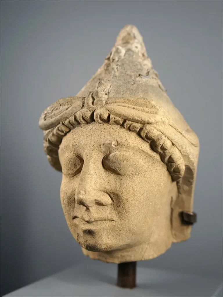
Ancient writers described it clearly enough. Herodotus mentioned it. Diodorus Siculus described it. Egyptian inscriptions called it Thonis. Greek texts called it Heracleion. For centuries, scholars argued about whether those were two different cities or one. Then, in 2000, French underwater archaeologist Franck Goddio resolved the argument by pulling a stone slab off the floor of Aboukir Bay, seven kilometers off the Egyptian coast, under roughly five meters of water.
The slab was a stele, a carved royal inscription ordered by Pharaoh Nectanebo I in the 4th century BC. Its text named the location explicitly as Thonis-Heracleion and described it as the main customs and taxation gateway into Egypt for Greek merchants arriving by sea. One city. Two names. One inscription that ended a debate that had run for centuries.
Goddio and his team at the Institut Européen d’Archéologie Sous-Marine (IEASM) had spent years before that moment running systematic marine surveys of Aboukir Bay, using sub-bottom sonar and side-scan imaging to map the seafloor before any diver went down. What they found, and have continued finding across more than two decades of excavation, is staggering in its scale. Colossal statues of pharaohs and gods. Bronze ritual vessels. Gold jewelry. Thousands of coins. The architectural remains of the grand Temple of Amun-Gereb. More than sixty ancient shipwrecks, many still holding their cargo.
In 2021, the team located a Ptolemaic military galley that had sunk when massive stone blocks fell from the temple and crushed it during a catastrophic event in the second century BC. The blocks pinned the ship to the canal floor. It lay there, under five meters of clay, for over two thousand years before the divers reached it.
The city had not been raided or burned. It sank. Beginning probably around the 8th century AD, the Nile Delta sediment beneath it liquefied under the weight of its own buildings while sea levels rose. What had been Egypt’s most important entry port simply subsided into the bay, taking its temples, its statues, and its archives down with it.
2. Aten, Egypt: The Largest Ancient City Ever Found in Egypt
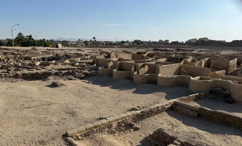
When Zahi Hawass’s team began digging between the temples of Ramses III and Amenhotep III in September 2020, they had a logical reason to be there. The mortuary temples of two other pharaohs, Horemheb and Ay, had already been found in the same area. Tutankhamun’s had to be nearby. Within weeks of breaking ground, the team realized they were not digging up a temple. They had found a city.
Announced in April 2021, the site drew immediate international attention. Betsy Bryan, Professor of Egyptian Art and Archaeology at Johns Hopkins University, called it the second most important archaeological find in Egypt since the opening of Tutankhamun’s tomb in 1922. The Egyptian Ministry of Tourism and Antiquities described it as the largest ancient city ever found in Egypt.
The city dates to the reign of Amenhotep III, who ruled Egypt from approximately 1391 to 1353 BC during one of the empire’s wealthiest periods. It served as a major administrative and industrial center on the west bank of the Nile, and the physical evidence makes that function concrete. Mudbricks stamped with Amenhotep III’s royal cartouche confirmed the date. Production facilities for amulets and decorative objects, metalworking areas, large-scale bakeries, and a meat-storage district where sealed vessels still held dried fish and dried meat showed what the city actually did. An unusual architectural feature, zigzag walls found across multiple structures, is rare in Egyptian construction and appears almost exclusively at the end of the 18th dynasty, which further pins the city’s active period.
The reason it was abandoned is well established. Amenhotep’s son, the pharaoh history knows as Akhenaten, dismantled the traditional Egyptian religion, elevated the sun-disc Aten as the sole state deity, and relocated the royal court to a brand new capital at Amarna. His officials packed up and left the west bank city behind. When Akhenaten died, his son Tutankhamun reversed the religious changes, but nobody moved back. The administrative city sat sealed under the desert for more than three thousand years while foreign expedition after foreign expedition searched the same ground and came away empty.
No peer-reviewed excavation report has been published to date. The site has been only partially excavated and its full extent is still unknown. What the stamped bricks, sealed rooms, and intact production facilities do confirm is that an entire working city of the Egyptian empire sat undiscovered in one of the most studied stretches of the ancient world.
3. Mahendraparvata, Cambodia: The Khmer Capital Hidden Under the Jungle
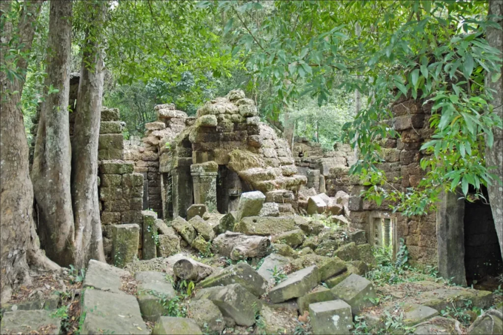
Archaeologists knew, from inscriptions and scattered stone carvings, that the earliest capital of the Khmer Empire had been founded on Phnom Kulen, a forested plateau about 40 kilometers north of Angkor Wat. The founder of the empire, Jayavarman II, had declared himself a god-king there in 802 AD. But the jungle on Phnom Kulen was so dense, and the ground so heavily seeded with landmines left by the Khmer Rouge, who had held the plateau as a final stronghold until 1998, that archaeologists could find only isolated shrines and individual carvings. The shape and scale of the city were completely unknown.
In 2012, archaeologist Damian Evans mounted a LiDAR sensor to a helicopter and flew a systematic grid over 370 square kilometers of Cambodian jungle. LiDAR fires laser pulses at the ground and measures the return time. Dense forest canopy scatters the pulses, but enough reach the ground and bounce back to produce a detailed three-dimensional map of what lies beneath the trees. Evans’s team collected billions of data points in a single week.
What the data revealed, confirmed in a peer-reviewed paper published in the journal Antiquity in 2019 by Jean-Baptiste Chevance, Evans, and their colleagues, was a formally planned urban grid covering between 40 and 50 square kilometers. Mahendraparvata had roads, dykes, ponds, and more than thirty previously unidentified temples arranged according to a coherent architectural plan. It was the first large-scale grid city the Khmer had built, and it laid the groundwork for the monumental complexes at Angkor that followed.
The researchers were careful in their conclusions. The water channels at the site do not appear to have been designed for rice irrigation, which had been the standard explanation for Khmer urban planning. The city was more likely a dedicated seat of civic and spiritual authority. That matters, because it shifts how historians understand what the Khmer Empire was actually building in its earliest phase and why.
Ground survey of Mahendraparvata is still limited by unexploded ordnance. The lasers could safely map what no archaeologist could safely walk.
4. Akrotiri, Santorini, Greece: The Bronze Age Town the Volcano Preserved
In 1866, workers quarrying volcanic earth on the Greek island of Santorini for use in the construction of the Suez Canal broke into ancient walls. The find attracted French geologists and later German archaeologists, but the full scale of what lay buried there only became clear in 1967, when Greek archaeologist Spyridon Marinatos began systematic excavation and started pulling back the ash.
Akrotiri was a prosperous Bronze Age settlement, inhabited from at least 4500 BC and connected to the Minoan civilization of Crete through its artifacts, its frescoes, and its inscriptions in Linear A, a script that has never been deciphered. The town stood at the southwestern tip of Thera, as the island was then known, and functioned as an active port in the Aegean trading network. Then, in the late 17th century BC, the volcano beneath the island erupted. The eruption buried Akrotiri under meters of ash and pumice and the island above it partially collapsed into the sea, which is how Santorini acquired its distinctive crescent shape.
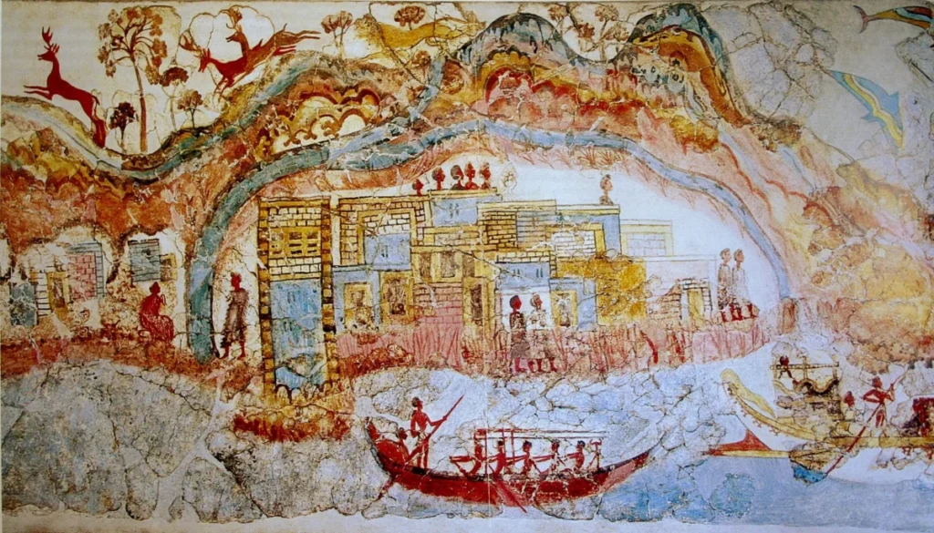
The ash did something the eruption’s violence might have prevented: it preserved the town almost perfectly. Multi-story buildings still stand. Frescoes showing seascapes, animals, and human figures remain on the walls. Ceramic vessels, drainage pipes running beneath the streets, and even wooden furniture reduced to ash casts are still in place. What is absent is human remains. Akrotiri shows no bodies, which is the opposite of Pompeii. The working interpretation is that earthquakes before the eruption gave the residents enough warning to evacuate.
The site is managed as an open archaeological park by the Greek Ministry of Culture, enclosed under a bioclimatic shelter that controls temperature and humidity to protect the exposed structures. Excavation has continued under Christos Doumas and the University of Athens since 1975. After more than fifty years of work, only about one-third of the site has been uncovered. The ancient name of the town is still not known.
5. Ebla, Syria: The City That Proved the Ancient World Was Bigger Than Anyone Thought
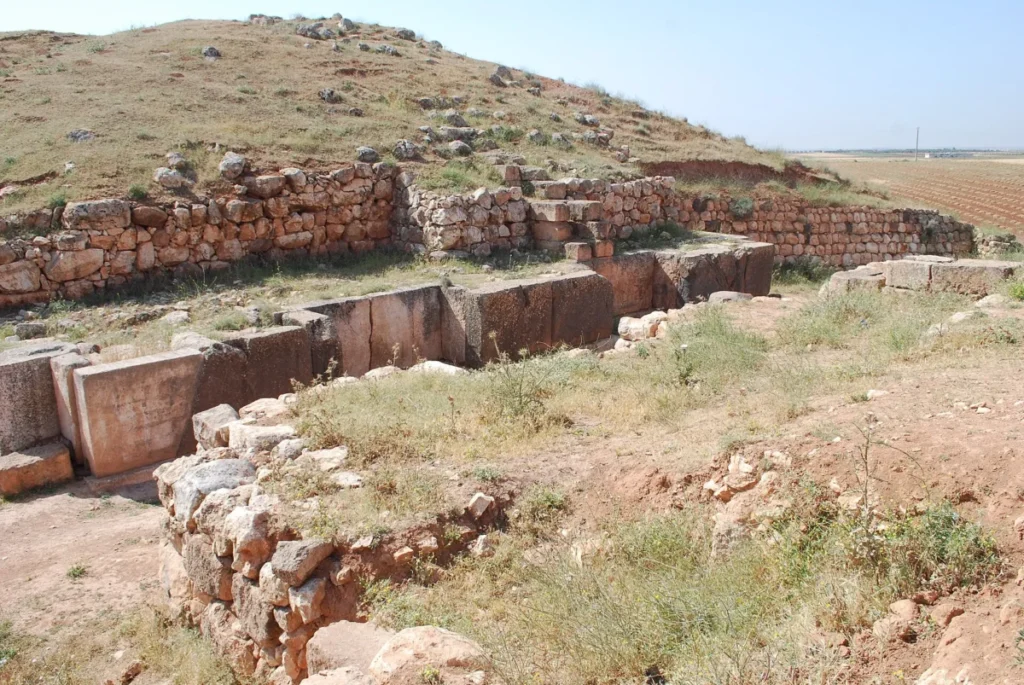
Before 1974, the standard scholarly picture of early urban civilization placed the great city-states of the ancient world in three regions: Mesopotamia, Anatolia, and Egypt. The territory between them was thought to be peripheral, useful mainly as a trade corridor. Then a team from the University of Rome La Sapienza, led by archaeologist Paolo Matthiae, pulled approximately 17,000 clay tablets out of a large mound in northern Syria called Tell Mardikh, and the standard picture needed rewriting.
Matthiae had begun work at Tell Mardikh in 1964, identifying it as a significant but unidentified Bronze Age site. The tablets appeared in 1974. They were inscribed in cuneiform in two languages: Sumerian, which was already well known, and an entirely unknown Semitic language that scholars named Eblaite. The tablets recorded diplomatic correspondence with other states, trade agreements, administrative accounts, and literary texts. They proved that Tell Mardikh was ancient Ebla, a city-state that had been thriving since at least 3000 BC and had reached the height of its power in the third millennium BC, at the same time the great pyramids were being built in Egypt.
Ebla at its peak had a population scholars estimate in the tens of thousands. It maintained diplomatic and commercial ties with cities across the Near East, including Mari and Akkad. Its palace held one of the earliest libraries ever found anywhere in the world. The tablets showed a level of administrative complexity and international reach that nobody had associated with this part of Syria before Matthiae’s team arrived.
The city was destroyed, most likely by the Akkadian king Naram-Sin around 2300 BC, then partially reoccupied, then abandoned again. By the time excavation began, it had been a featureless mound for over three thousand years. The tablets sitting inside it had redrawn the map of ancient civilization.
6. Ciudad Perdida, Colombia: The Tairona City the Black Market Gave Away
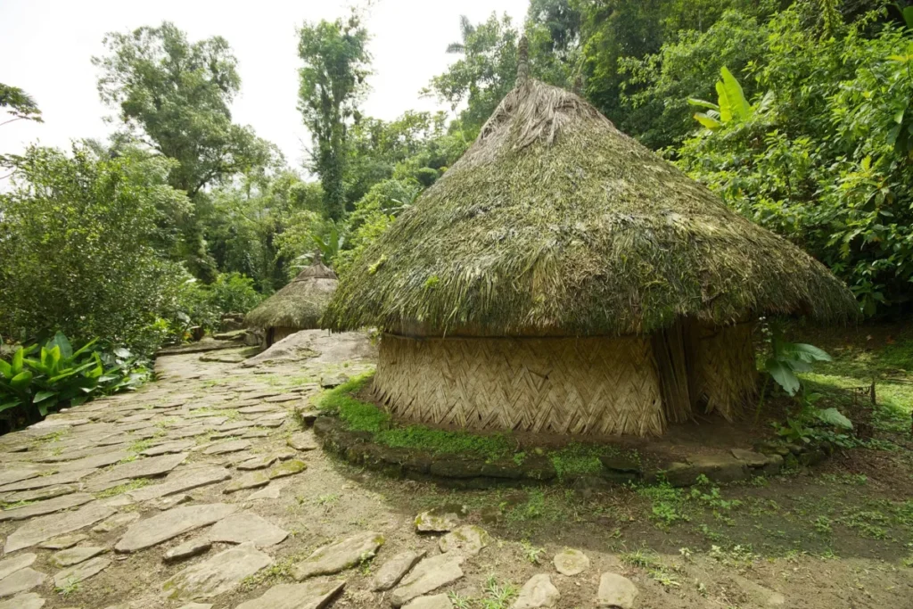
In 1972, gold figurines and ceramic urns of an unfamiliar style began appearing on the black market in Colombia’s Caribbean coastal region. Colombian authorities traced the objects back through the network of guaqueros, the local term for grave robbers, who had found their source. The trail led deep into the Sierra Nevada de Santa Marta mountains, to a site hidden in dense jungle at roughly 1,300 meters elevation. The looters had been quietly extracting material from an ancient city for months before any archaeologist saw it.
The official response came in 1976, when a commission from the Instituto Colombiano de Antropología e Historia (ICANH) led by archaeologists Luisa Fernanda Herrera and Gilberto Cadavid documented and began excavating the site, officially designated Buritaca-200. The public came to know it as Ciudad Perdida, the Lost City.
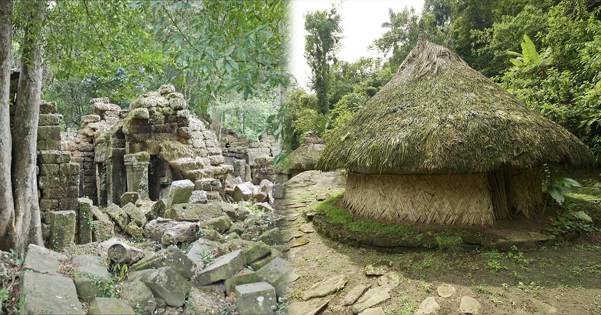
What they found was the principal urban center of the Tairona civilization, built around 800 AD on a narrow mountain ridgeline in the Sierra Nevada. The city is constructed on 169 stone terraces carved into the steep mountainside, each one providing a level platform for buildings, plazas, and storage. A network of stone-paved roads and staircases, including a final ascent of more than 1,200 steps, connects the lower approaches to the civic and ceremonial center at the ridge. Drainage canals run throughout, engineered to handle the heavy tropical rainfall. The city predates Machu Picchu by approximately 650 years.
The Tairona abandoned the site sometime in the 16th or 17th century, almost certainly in response to the violence and disease that followed Spanish colonization of the surrounding lowlands. The indigenous peoples of the Sierra Nevada, including the Kogi, Wiwa, Arhuaco, and Kankuamo communities, had never lost knowledge of its existence and continued to visit it. For everyone outside those communities, it was invisible until the gold started moving through the black market.
ICANH reconstructed the site between 1976 and 1982. It has operated as a managed archaeological park ever since, with less than 10 percent of the city excavated to date.
7. Canopus, Egypt: The Sunken Religious Capital Found Alongside Thonis-Heracleion
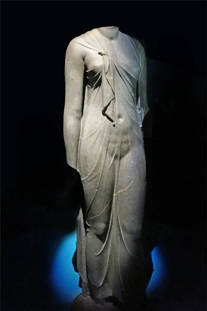
When Franck Goddio’s team began their marine surveys of Aboukir Bay in the 1990s, Thonis-Heracleion was their primary target. They were not specifically looking for a second city. Canopus found them.
Ancient geographers had described Canopus as a major religious center on the Egyptian coast, famous above all for its sanctuary of Osiris and for an annual ceremony in which the god’s effigy was carried by boat from Thonis-Heracleion to rest at its shrine. Strabo wrote about it. Egyptian religious texts described the procession in detail. But the city’s precise location had been lost, and no modern archaeologist had found physical evidence of it. Then the IEASM sonar surveys began returning signals from a second cluster of submerged structures in the same bay, a few kilometers from Thonis-Heracleion.
What the divers found confirmed what the ancient texts had described. Canopus had been a substantial city in its own right, with monumental architecture, ritual deposits, and material culture distinct from its neighbor. Statues, bronze ritual objects, ceramic vessels, and architectural elements have all been recovered from the site. The religious function of the city, the one detail ancient writers had consistently emphasized, was physically confirmed by the objects found there.
Like Thonis-Heracleion, Canopus had sunk into the bay as the Delta sediment beneath it gave way. The two cities had operated as linked nodes in the same coastal and religious network, and they went under at roughly the same time for the same geological reasons. Finding one without the other would have left the picture incomplete. The bay, it turned out, had preserved both.