
Archaeologists excavating Sardis in western Türkiye reported in August 2025 that they had reached substantial Lydian masonry roughly eight metres beneath the later city. Some walls measured about 1.5 to 2 metres thick and survived to more than six metres high. The walls belong to successive buildings and terraces in a district long suspected to contain the royal palace. Part of the construction was assigned to the eighth century BCE, well before the later Lydian rulers whose wealth and coinage made Sardis famous.
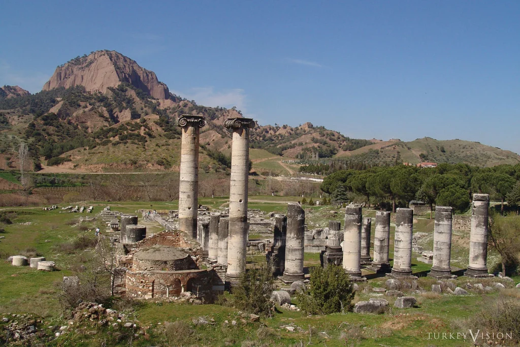
The city occupied the slopes below Mount Tmolus, above the Hermus plain in western Anatolia. Sardis became the capital of Lydia, which controlled much of the region during the seventh and sixth centuries BCE. The kingdom’s best-known ruler, Croesus, was defeated by Cyrus the Great of Persia in the middle of the sixth century. Persian, Hellenistic, Roman and Byzantine inhabitants continued to live and build at Sardis. Each period left structures above, beside or cut through the earlier Lydian settlement.
The early walls suggest that Sardis possessed substantial architecture, and perhaps stronger centralised political institutions, earlier than some reconstructions had allowed. But the August 2025 findings formed part of a long excavation history. The probable palace district, its terraces and remains of buildings associated with elites had been studied over decades. The 2025 walls belong to a sequence that decades of excavations had already begun to reveal.
What the 2025 excavations actually uncovered
On 15 August 2025, Anadolu Agency reported the field director Nicholas Cahill’s account of the latest excavations. The team had passed through later occupation deposits to reach Lydian levels around eight metres below the surface. The account mentioned terracing, remains interpreted as palatial buildings and luxury houses, and early courses of masonry placed by Cahill in the eighth century BCE. A separate contemporary account in Hürriyet Daily News described more than one architectural phase, including remains from the early sixth century and construction beneath them. The newly reported walls were thus parts of several construction phases, rather than a single building.
The measurements in the announcement refer to different features. Eight metres is the approximate depth of particular excavations, not the height of a palace or the depth at which every Lydian structure lies. The reported masonry, 1.5 to 2 metres across and more than six metres high in places, indicates major engineering. It does not provide a plan of royal apartments, treasury rooms or an audience hall. Some of the largest walls appear to have retained earth and stone, making level terraces on a steep natural slope.
Cahill was cautious about dating the earliest phases. In a January/February 2026 interview in Archaeology, he said that some of the new walls might belong to the eighth century, perhaps even the ninth. Walls rebuilt along similar alignments may belong to different centuries. The excavators are still separating individual building episodes in a district altered repeatedly over centuries.
News reports also discussed roughly thirty bronze arrowheads, human bone fragments and nine silver coins. The objects came from the palace quarter, but not from one newly excavated eighth-century room. Some had been excavated in previous years, and certain finds came from the destruction associated with the Persian conquest in the sixth century BCE. Their dates must be kept separate from those of the oldest structures.
Where the palace quarter lies in Sardis
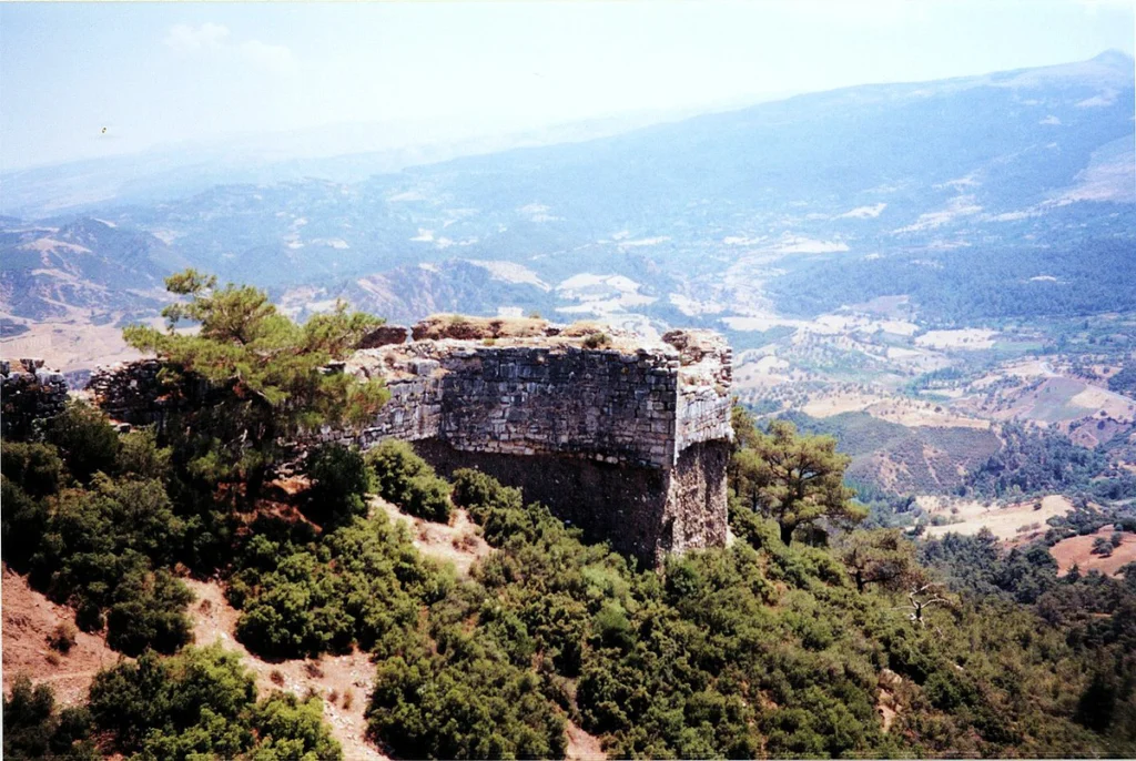
The excavation area lies approximately a kilometre east of the Roman bath-gymnasium, below the acropolis and toward the centre of ancient Sardis. Two projecting spurs carry the excavation names ByzFort and Field 49. The first name reflects an earlier interpretation of the hill; it does not imply that the Lydian terraces there were built in Byzantine times. Builders repeatedly enlarged these spurs and levelled their uneven surfaces, creating platforms on ground that originally descended sharply toward the lower town.
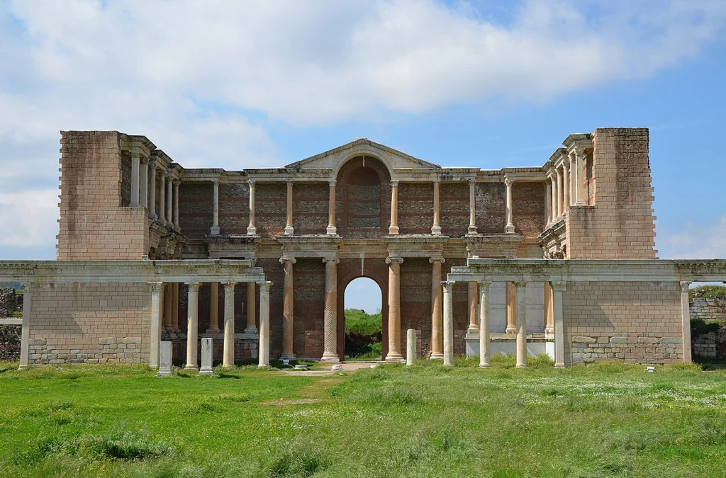
Visitors to Sardis often notice the Roman bath-gymnasium and its restored Marble Court first. The monument is much later than the Lydian palace district. The terraces of ByzFort and Field 49 occupy higher ground between the inhabited plain and the fortified summit. The Sardis Expedition’s detailed account of the city describes their commanding position, elaborate masonry and closeness to the acropolis, all reasons to investigate them as possible sites of important residences or royal buildings.
The steep summit served as the naturally defensible acropolis. Below its northern slopes, the ByzFort and Field 49 terraces created room for occupation, while a Lydian fortification wall protected the city’s central area. People also settled outside that enclosure, including near the Pactolus stream. Once excavations established the course of the city wall, archaeologists had to abandon an older picture that placed the entire Lydian settlement along the Pactolus.
In his 2023 archaeological study of the Lydian palaces, Cahill proposed that ByzFort, Field 49 and the rising ground behind them covered approximately 5.8 hectares. This was an estimate of the palace district, not the footprint of a single excavated building. How the ground was divided between buildings, courts and other facilities, and exactly where the district began and ended, remains uncertain.
How Lydian builders made a palace out of a hillside
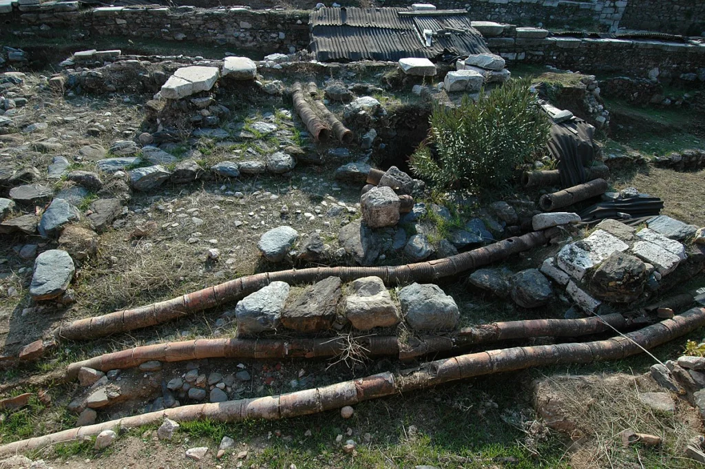
Lydian builders faced a practical problem beneath the acropolis: there was no wide level surface on which to construct a major complex. They cut into the hillside and erected large retaining walls, packing stone, soil and rubble behind them to form terraces. A carefully built masonry face could therefore conceal a much greater depth of fill. At ByzFort, Cahill describes limestone facing supported by schist blocks and rubble, with packing at least eight metres deep in some places and a terrace rising to about twelve metres.
Such a wall need not have belonged to the outer face of a multi-storey palace. Retaining walls held back a hillside or platform, while the walls of occupied buildings bounded rooms and supported their roofs. Archaeologists distinguish their functions by examining foundations, floors, openings and neighbouring deposits. These relationships are complicated at Sardis because builders enlarged terraces, dismantled earlier features and incorporated old dressed stones into later structures.
Dating an early retaining wall is difficult for similar reasons. A wall might remain standing for centuries, even if buildings above it changed. Material sealed below a foundation provides a limit before which it could not have been built; a securely related destruction layer may indicate when part of the complex went out of use. Pottery or coins brought in as later fill do not automatically date the original masonry. Hellenistic and Roman construction cut through older levels at Sardis, while Lydian limestone blocks were often quarried for reuse.
Earlier excavations had already established monumental building at Sardis before 2025. The expedition’s documented aerial surveys and excavation descriptions already described Field 49 walls thought to date to the eighth century or earlier. Previous work had also identified a mudbrick building probably belonging to the ninth century BCE. The latest discoveries add to that earlier evidence, but no one wall and no single excavation season can by themselves establish the plan and date of an early royal residence.
The city was monumental before Croesus
The most imposing dressed-limestone terraces at ByzFort and Field 49 have often been linked with Croesus and the later kings of Lydia. They probably belong to the first half of the sixth century BCE. Yet Cahill’s 2023 research documents buildings beneath this monumental phase. Radiocarbon evidence placed a substantial mudbrick structure on Field 49 in the later ninth century, with its destruction in the first half of the eighth century BCE. Important architecture therefore stood on the hillside well before the reign associated with the great limestone terraces.
The excavated sequence changes from one part of the hillside to another. Walls and floors belonging to separate phases sometimes follow much the same lines after rebuilding. A ninth-century structure cannot be assumed to have occupied the whole later palace zone, and there is no basis for placing an eighth-century king in the precise rooms used by a later royal household. What the remains do show is investment in durable construction during a period when Sardis appears only faintly in surviving written testimony.
Builders had begun altering the hillside long before the historical Lydian monarchy. Cahill reports deep deposits and radiocarbon dates indicating that Field 49 was already being modified during the late third millennium BCE, in the Early Bronze Age. Those builders lived more than a thousand years before the attested Lydian kingdom. Their terraces are part of the site’s architectural history, though they cannot reasonably be credited to Lydian kings whose society had yet to emerge.
Research published since the August announcement has further separated the phases. In a study published on 28 April 2026, archaeologist Güzin Eren argued that relatively short stepped terraces, dated to the late seventh and early sixth centuries BCE, preceded and helped shape the construction of the high platforms associated with Croesus. Eren relates those intermediate terraces to Alyattes, Croesus’s father. Her reconstruction distinguishes masonry types and building episodes instead of assigning every part of the district a single eighth- or sixth-century date.
Why archaeologists identify a royal complex here
The case for a royal complex rests on more than the size of the terraces. Large platforms alone could support sanctuaries, civic buildings or elite residences as readily as a palace. At Sardis, the proposed interpretation draws on the central location, masonry quality and objects recovered nearby. Fragments of fine marble architecture, decorated roofs, costly pottery, bronze furniture fittings and carved stone suggest occupation and building projects above ordinary household scale. The collection is persuasive as evidence of a high-status quarter, even where the specific purpose of an individual building remains unknown.
Cahill’s 2023 synthesis discusses a small marble stylobate, or column-supporting base, at ByzFort, perhaps associated with a porch or pavilion. It also records reused elements of an imposing doorway, painted architectural terracottas and coloured jasper fragments possibly connected with work for elite clients. On Field 49, the finds include a seal, bronze fittings, ivory furniture inlay and fine ceramics from disturbed destruction deposits. These materials help characterise the district. Because some had been moved from their original positions, they cannot all be assigned to a particular room as though the buildings had been found intact.
The site’s position supports the palace hypothesis, and archaeologists have also considered another possible palatial district on the acropolis. A tunnel between that area and the lower terraces has been proposed, but the connection remains hypothetical. A royal establishment might have comprised residences, storage rooms, courts, service buildings and religious spaces rather than a single edifice. So far, too few complete rooms have survived to establish such an arrangement securely.
The palace known to ancient writers
Ancient descriptions of Croesus’s palace long predate archaeological attempts to locate it. In Herodotus’s Histories 1.30, Herodotus has the Lydian king entertain the Athenian Solon and display his prosperity. Herodotus wrote well after the kingdom’s destruction and shaped the episode as a reflection on wealth and the uncertainty of human fortune. His story shows how the palace figured in Greek historical imagination. It provides no means of identifying any excavated masonry as Croesus’s reception room.
The Roman architectural writer Vitruvius, On Architecture 2.8.10 supplies a different tradition. In the first century BCE, he stated that the people of Sardis used Croesus’s house as a gerousia, a council meeting place for elders, while discussing the durability of mudbrick architecture. Later scholars have tried to connect his description to visible ruins. Cahill points out that the actual Lydian structure could have been dismantled and its stone reused long before Vitruvius wrote. The author might also have repeated a local identification whose accuracy is now impossible to test.
An earlier generation of excavators identified the imposing Roman bath-gymnasium as Croesus’s palace. Its size made the suggestion attractive, but its date ruled it out. The history of the search reconstructed in the 2023 excavation report traces the subsequent shift of attention from obvious later monuments to less visible Lydian architecture on the hillside. The modern case for a palace at ByzFort and Field 49 rests on archaeological evidence and interpretation, without an inscription preserving a royal building’s name.
The arrowheads and bones belong to a later disaster
The sixth-century layers bring the investigation into the period of Lydia’s conquest by Persia. Cyrus the Great took Sardis in the mid-sixth century BCE, traditionally in 547 BCE, though the exact year remains debated. Herodotus 1.84 tells how a Persian soldier climbed an inadequately guarded part of the acropolis after watching a Lydian descend to recover a fallen helmet. The episode is Herodotus’s account of the siege, not direct military documentation. Excavated traces of damage from roughly the same period provide a separate form of evidence.
At Field 49, burned deposits contained arrowheads, human skeletal fragments and broken luxury objects; heat had fused some of the arrowheads. In his 2023 paper, Cahill described at least twenty gathered in disturbed destruction debris and discussed further weapons and bones associated with a more securely preserved sixth-century context. The material is compatible with violence at the time of Lydia’s defeat. It does not demonstrate that everyone represented by the bones died in battle or that the weapons were kept in a palace armoury. The disturbed objects need not have come from a single instant of fighting.
Reports issued in 2025 referred to approximately thirty arrowheads and human remains associated with the palace area. Earlier excavation publications already recorded similar finds, so the total should not be treated as a count of thirty newly discovered weapons from August 2025. A complete new inventory and stratigraphic information would be needed to make that claim. The important connection is between some of these finds and the sixth-century destruction, rather than between the weapons and the first building phase centuries earlier.
Nine silver coins and the person who carried them
The nine silver coins have a documented excavation and publication history. They were found in 2021, appeared in Cahill’s 2023 study and received detailed examination in a 2025 Hesperia article by Cahill and nine co-authors. References to them in the August 2025 news coverage do not change the date of discovery. Their significance lies in a well-documented association with a person and a destruction deposit in the palace quarter.
The coins were croeseids, struck as part of the gold-and-silver currency associated with Croesus, with the facing foreparts of a lion and a bull. The nine silver pieces lay near human remains in a layer connected with the Persian capture. The numismatic study identified two larger staters and smaller fractional pieces and noted considerable wear from circulation. Their context connects currency in circulation with the destruction of the building.
On the evidence of their wear, the researchers argued that the coins had circulated for more than fourteen years before burial. That conclusion favours a longer reign for Croesus than the conventional chronology beginning around 561 BCE. It does not date the origin of all coinage or reveal when the eighth-century terraces were constructed. The pieces help date and interpret the sixth-century destruction context and show that this currency was circulating before the Persian conquest.
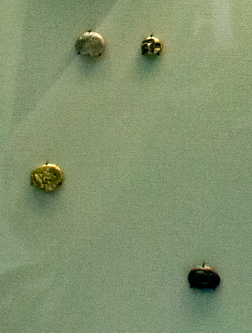
Lydian coinage had developed before the silver croeseids. Lydian coinage developed within economies that already used weighed metals and other means of exchange, and struck electrum coins, made from a gold-silver alloy, appeared in the late seventh century BCE. Later issues associated with Croesus used gold and silver separately. Numismatist John Kroll’s study for the Sardis Expedition examines the relationship between these phases and the evidence of coins excavated in securely dated contexts. In Histories 1.94, Herodotus calls the Lydians the first people known to him to mint gold and silver currency. His statement is ancient testimony, which must be evaluated together with the surviving coins and their archaeological dates.
How archaeologists date walls buried beneath later cities
Later generations occupied and rebuilt Sardis long after the Lydian kings disappeared. Persian administration was followed by changes under Hellenistic rulers after Alexander’s conquest. Roman builders laid out streets and great public complexes, and Byzantine occupants reused or rebuilt existing structures. Their works cut into earlier layers and moved considerable amounts of soil and stone. An excavation trench can pass through evidence from all these periods without encountering a simple, uninterrupted stack of deposits.
Archaeologists therefore study stratigraphy: the relationships among walls, floors, cuts and accumulated layers. A floor joining a wall can provide evidence for a building’s use; foundation trenches establish sequences of construction; a sealed collapse may mark an episode of destruction or abandonment. Pottery, radiocarbon samples and coins offer additional dates, but their context determines what can be concluded. An old sherd redeposited in later fill dates the object, not the wall beneath it, and a coin may continue circulating long after it was struck.
At Field 49, finds and walls extend from the Early Bronze Age through Roman occupation, with underlying bedrock dropping steeply in places. The excavators’ published plans and stratigraphic discussion demonstrate why archaeological depth alone cannot assign a period to masonry. The ninth-century mudbrick building, early eighth-century constructions, Alyattes’s possible stepped terraces and the platforms linked to Croesus are successive parts of a complex architectural history, not one securely dated monument.
The exposed structures are vulnerable to damage after excavation, especially where they contain mudbrick, fragile mortar joints and weathered surfaces. According to the 2025 reports, the team covered the palace-area remains again at the end of the season and intended to continue investigations in 2026. Protective backfilling reduces weather damage, but it also means visitors should not expect every wall in the announcement to be visible.
The Lydian royal landscape extended beyond the palace
The landscape around Sardis includes the great burial mounds of Bin Tepe. In July 2025, UNESCO inscribed Sardis and the Lydian Tumuli of Bin Tepe as a World Heritage property. The inscription brings together the ancient capital and Bin Tepe, the plain to its north that contains more than a hundred earthen burial mounds, or tumuli. Several are enormous and have traditionally been assigned to members of the Lydian royal family. Individual identifications and dates nevertheless depend on archaeological investigation, rather than monument size alone.
The great mound attributed to Alyattes, Croesus’s father, was already celebrated in antiquity. In Herodotus 1.93, Herodotus describes a stone foundation under an earthen mound and recounts which groups supposedly contributed to its construction. His narrative shows that the monument was famous by the fifth century BCE. The detailed story of its financing cannot simply be accepted as an independently verified account. The size of the burial mounds does, however, indicate the enormous labour invested in the Lydian elite’s funerary landscape.
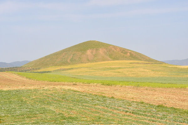
The tumuli and the hillside terraces performed different functions. The mounds dominated a burial ground on the plain; the terraces provided substantial building space within the capital. Both required materials, skilled engineering and organised labour. Seen together, they reveal more about Lydian authority than the Greek stories of Croesus’s treasure by themselves. How the kingdom recruited labour or administered such projects is still poorly documented by surviving texts in the Lydian language.
The Pactolus, gold and the limits of the coinage story
Sardis’s wealth was closely associated with the Pactolus, a stream whose sediments contained gold. The tale that the Phrygian king Midas washed away his golden touch there is mythological, although the stream’s gold-bearing character reflects an actual regional resource. That story cannot determine when or on what scale people extracted gold. Sardis also drew on stone and timber from the surrounding mountains, agricultural production on the Hermus plain and routes linking the Aegean coast to inland Anatolia.
The location made the city a meeting point for commercial and political contacts with Greek coastal communities and inland powers. The expedition’s survey of Sardis describes its geographical resources as well as the fortifications of the lower city. The palace terraces formed part of this wealthy urban setting. Yet the walls themselves provide no direct record of the collection of taxes, the administration of building labour or the place where Lydian coins were struck.
By the sixth century BCE, Croesus’s separate gold and silver issues attest to developed monetary practices. Those practices cannot be assigned without evidence to the occupants of an eighth-century structure. The oldest walls predate the phase of coinage best documented by archaeology. Their scale supports an interpretation of substantial construction and elite investment, but does not prove that coins were minted there, workers received silver wages or a treasury occupied the excavated buildings.
What remains unknown about the early palace
The outline of the early palace quarter remains incomplete. Excavators cannot yet say how many structures stood on its eighth-century terraces, what their entrances looked like or whether individual buildings housed kings, other powerful families or sanctuary officials. The location and elaborate architecture make a high-status or palatial complex a reasonable interpretation. No surviving inscription identifies the function of each early building as royal.
A terrace could have been built in one period, expanded in another and used long afterward for different structures. The eighth-century masonry does not necessarily support the same rooms as the later limestone platforms. Proposed plans with guardrooms, ceremonial routes, storage chambers and audience halls remain possibilities rather than archaeologically documented spaces. Until more connected floors, foundations and entrances are excavated, the details of such reconstructions cannot be established.
Questions also remain about the coins and skeletal remains. The 2025 Hesperia publication examines the silver currency and its circulation, while excavation accounts address the surrounding destruction and architecture. Further research may clarify precisely how individual objects relate to the people represented by the bones and to the final Lydian phases before Persian rule. Additional excavation may also connect the eighth-century walls more securely with the ninth-century mudbrick structures and older Bronze Age alterations.
What the Sardis excavation changes about Lydia
The August 2025 excavations have refined the chronology of a hillside district already known to contain several phases of monumental architecture. The oldest Lydian remains show major construction before the ages of Gyges, Alyattes and Croesus familiar from Greek historical writing. Later terraces demonstrate how builders converted steep spurs into prestigious building platforms. The sixth-century destruction levels preserve another history: the people, objects and damage associated with the fall of Lydia.
Architecture and destruction deposits provide evidence for different episodes in the district’s history. An early retaining wall documents engineering and construction; decorated architectural fragments suggest high-status use; circulating coins, human remains and arrowheads help reconstruct the much later crisis of Persian conquest. Keeping those dates separate shows a palace district repeatedly altered across generations. It also explains the excavators’ caution about identifying specific rooms in structures whose stone has so often been removed or reused.
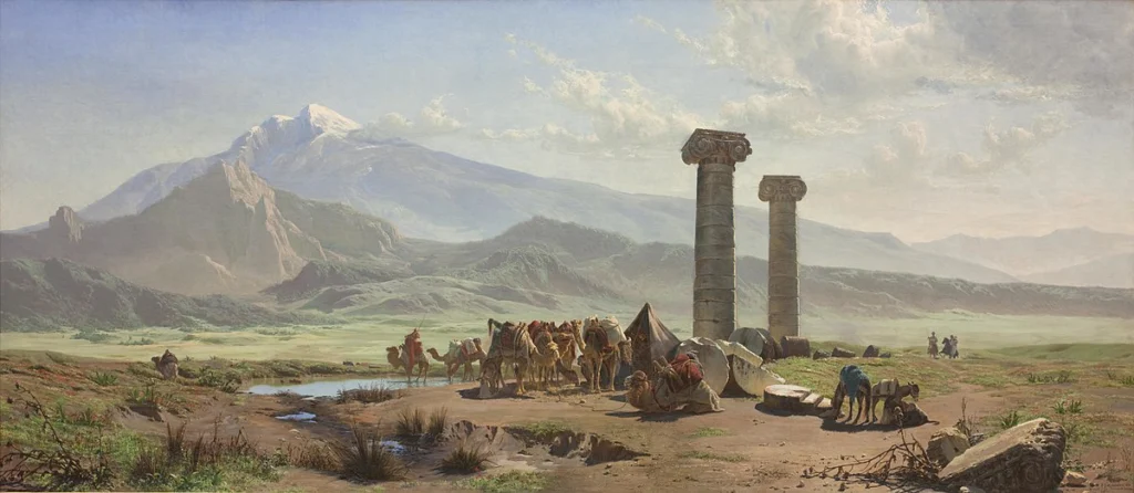
Sardis had a long history of remaking its hillside before Croesus became its best-known king, and people had worked the same ground before the historical kingdom of Lydia existed. Excavation is now bringing that sequence into view, though the functions of the earliest terraces are still uncertain. Excavation has yet to establish exactly when these terraces became the royal establishment later remembered as the palace of the Lydian kings.